2022
June 14 - 16, Yreka, California

SCHEDULE OF EVENTS
Tuesday, June 14, 20224:00 pm to 7:00 pm Registration
5:00 pm to 6:30 pm Reception (no-host)
6:30 pm to 9:00 pm Dinner
Wednesday, June 15, 2022
7:00 am to 8:00 am Breakfast
8:00 am to 11:35 am Welcome and Technical Presentations
11:35 am to 12:30 pm Lunch
12:30 pm to 5:15 pm Technical Presentations, Evaluations, Remarks
6:00 pm to 11:00 pm Dinner and Networking Session
Thursday, June 16, 2022
7:00 am to 8:00 am Breakfast
8:00 am to 12:00 pm Technical Presentations
12:00 pm to 12:20 pm Speaker and Attendee Recognition
12:00 pm to 12:20 pm Concluding Remarks and Evaluations
12:20 pm to End Lunch
Controlled Helter-Skelter: A Tale of Chain Controls and Traffic Queuing
Keith Koeppen, Caltrans District 2

|
Interstate 5 is a major north-south freight corridor. In northern California, it is often impacted by winter operational and safety issues such as low visibility, severe weather, icy roadways, road closures, plowing operations, and chain conditions. When winter restrictions are in place for screening and/or passenger and freight vehicle restrictions through the corridor, significant and unorganized traffic queuing for several miles often results. To enhance worker safety, manage throughput, and reduce queuing while screening and restrictions are in effect, District 2 Office of ITS Engineering and Support collaborated with maintenance and operations to develop a system that would allow maintenance and operations to manage the corridor more efficiently using a system with changeable message signs (CMS), blank out signs (BOS), and Lane Control signs (LCS). Keith provided background on the problems and solutions and discussed project development. He reviewed challenges encountered with a design by committee approach, integration of the project into existing central systems, network and physical architecture, and operation of the system. |
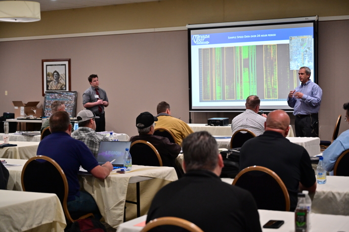
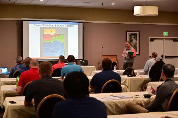
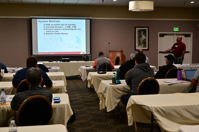
UDOT's Region Four Variable Speed Limit (VSL) I-15 Corridor in Rural Utah
Troy C. Torgersen, Utah Department of Transportation

|
To set the stage for the current VSL project along the I-15 corridor, Region 4’s ITS Project Manager Troy Torgersen provided some background, history and lessons learned from the Variable Speed Limit system deployed in the Salt Lake area along Interstate 80. He then discussed the process of designing and implementing a VSL algorithm for the project. He detailed the equipment necessary for a fully autonomous VSL system and how it was designed and implemented. He reviewed system construction and concluded with lessons learned for materials, construction, and site and equipment placement. |
Evaluation of Road Weather Messages on DMS Using Roadside Pavement Sensors
Skylar Knickerbocker and Zach Hans, Iowa State University

|
Winter weather and its corresponding surface conditions impact the safety and mobility of thousands of motorists annually. Highway agencies spend millions of dollars in resources and personnel in an effort to ensure safe and efficient travel. One such strategy is to use dynamic message signs (DMS) that have been deployed to alert drivers of conditions ahead based on data from roadside sensors. An Iowa State Research Engineer, Skylar Knickerbocker, described one such system deployed by the Minnesota DOT. Skylar discussed his project that analyzed driver behavior when advisory messages triggered by pavement sensors were displayed on DMSs. He reviewed the methodology and data analysis employed and discussed the results of the analysis. Skylar concluded with potential benefits demonstrated by the system and possible next steps based on the study’s results. |
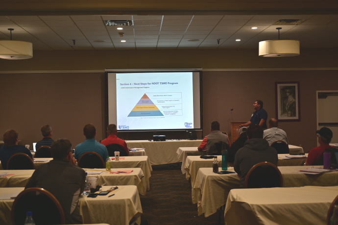
The Nevada TSMO Program – A Modern Approach to Solving Old Problems
LaShonn Ford, Nevada Department of Transportation

|
As the title indicates, this presentation discussed Nevada’s efforts to shift its approach for addressing traditional challenges away from capacity building projects to an increased focus on systems management and operations, a strategy known as Transportation Systems Management and Operations, or TSMO. Mr. Ford gave a brief introduction to TSMO, what it is and what specific strategies could be implemented. He then explained where NDOT started with the process, its progress to date, goals, example projects, and next steps. He concluded by sharing some of the challenges faced, NDOT solutions to those challenges, and the lessons learned. |
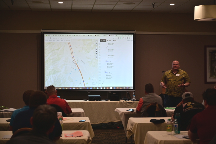
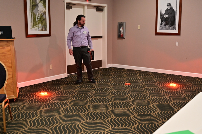
Next Generation Work Zone Data Integration and Dissemination – Work Zone Data Exchange (WZDx) Development from Planning to Operations
Justin Belk and Joshua Hudson, Washington State Department of Transportation

|
Washington State DOT is proactively developing and integrating a work zone database with increasingly automated confirmation of traffic impacting events as they go live. Justin and Joshua started with a big picture overview of the smart work zone efforts, scope, and goals for the system. They discussed WSDOT work zone deployments and associated data efforts including the WZDz Demonstration Grant in partnership with the North/West Passage Pooled fund. The team discussed experiences integrating third-party devices and schema, and their efforts to deliver an open standard format product for any state to use in a work zone feed. The pair demonstrated the features of the work zone data base as well as a Pi-Lit set-up populating the work zone data feed. They concluded with a review of lessons learned. |

UDOT’s Region Four Conflict Warning System Phase 2
Troy C. Torgersen, Utah Department of Transportation

|
At the 2019 Western States Forum, Utah DOT detailed the design and implementation of four Rural Intersection Conflict Warning Systems (RICWS) deployed in an effort to reduce the number of serious crashes at rural intersections. Recently tasked with focusing on implementing technology to reduce crashes on rural routes, UDOT Region 4 chose to work on a lower cost solution to the previously installed conflict warning systems. Troy first reviewed what was deployed with the first project. He then discussed the changes made to allow installation of equipment at ten intersections for the same cost of the four intersections covered in the previous project. |

Commodity Traffic Cameras as Cost-Effective Alternative to Traditional Sensing Hardware
Dan Rossiter, Southwest Research Institute

|
While sensor deployments along roadways have expanded rapidly over the past decade, the dedicated sensing equipment historically required for real-time traffic pattern and weather condition insights remains too costly for widespread deployment. Mr. Rossiter discussed some of the recent advancements in machine learning and computer vision technology which have the potential to collect some of the real-time data without the need for dedicated sensing equipment. He discussed how agencies could leverage existing traffic cameras, which tend to be relatively cheap and widely deployed, and combine the technology with software able to observe video feeds in real time to get many of the benefits of dedicated sensing equipment without deploying any new field hardware. |
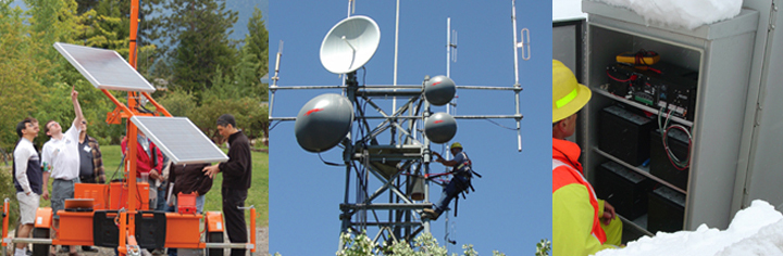
Traffic Monitoring Using Fiber Optic Sensing
Eric MacGill and Jeffrey Bickett, Nevada Department of Transportation
 and Eric MacGill (right)")
|
Distributed acoustic sensing is an exciting technology that is using spare or unused fiber optic cable along a roadway to detect traffic. Sensors and associated algorithms capture vehicle noise and vibrations to predict traffic flow indicators such as average speeds and traffic queueing. Eric and Jeff explained how the technology works and then went into detail on their current pilot project along a challenging 25-mile section of I-15 and I-95 in Las Vegas. They concluded with their initial findings from the project – pros, cons, and additional considerations for future deployments throughout the state. |