

SCHEDULE OF EVENTS
Monday, June 16, 20254:00 pm to 7:00 pm Registration
5:00 pm to 6:30 pm Reception (no-host)
6:30 pm to 9:00 pm Dinner
Tuesday, June 17, 2025
7:00 am to 8:00 am Breakfast
8:00 am to 11:55 am Welcome and Technical Presentations
11:55 am to 1:30 pm Lunch and Founders Panel
1:30 pm to 5:00 pm Technical Presentations, Evaluations, Remarks
5:45 pm to 11:00 pm Dinner and Networking Session at Upper Greenhorn Park, Yreka
Wednesday, June 18, 2025
7:00 am to 8:00 am Breakfast
8:00 am to 11:40 am Technical Presentations
11:40 am to 12:10 pm Speaker and Attendee Recognition
12:10 pm to 12:30 pm Concluding Remarks and Evaluations
12:30 pm to End Lunch and Celebration
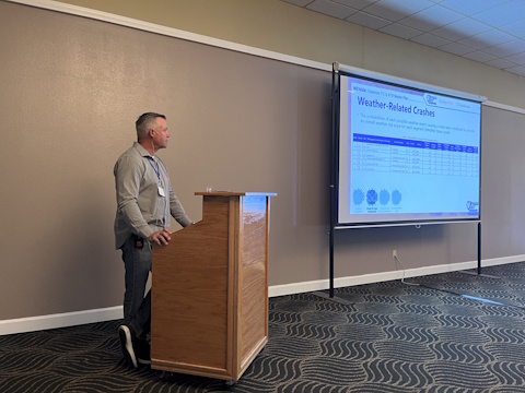
Pikalert: NSF-NCAR's Road Weather Hazard Prediction System (pdf)
Tom Brummet
National Center for Atmospheric Research (NCAR)

|
After hearing a similar presentation on this topic, a Forum steering committee member encouraged NCAR’s Tom Brummet to submit an abstract to present the Pikalert system at the Forum. Pikalert is an advanced Maintenance and Decision Support System (MDSS) that includes cutting-edge weather forecasting and hazard assessments out to 72 hours for each road segment and RWIS station within a state’s roadway network. Pikalert is currently installed and configured for real-time operations for five state DOTs – Alaska, Colorado, Iowa, Oregon, and Wyoming. Tom started by explaining how Pikalert started and has evolved into the current system. He demonstrated the real-time web display to show the system’s features and discussed in detail the various data inputs to the system, how they are processed and ultimately displayed. Tom reviewed recent enhancements to the Pikalert system and concluded with discussion on measuring success of the system, project challenges and opportunities, future work, and related research of interest to the project. |
Tom Brummet, National Center for Atmospheric Research (NCAR)
Photo by Leann Koon
Montana Transportation Management Center (TMC) (pdf)
Curtis Buckley
Montana Department of Transportation

|
Montana’s TMC Supervisor, Curtis Buckley, discussed in detail how the Statewide Montana TMC was established from the ground up. He described all aspects of the process and the operations, including establishing statewide radio communications, building and workstation design, staffing, telephone system configuration, call logs and centralization of services. Curtis discussed differences in winter and summer road reporting processes, controlling and crafting messages on variable message signs, and the move to a modern COTS product to replace the internal traveler information system. He also explained the importance of building trust and relationships with MDT staff, law enforcement, and other emergency communication centers, and spent time reviewing the challenges, wins, and benefits of building and operating the new TMC. |
Curtis Buckley, Montana Department of Transportation
Photo by Leann Koon
Developing The Plan – Integration of ITS into Mobility Plans
Nevada Statewide ITS & ATM Master Plan (pdf)
Jordan James, Kevin Maxwell
Nevada Department of Transportation

|
The Nevada DOT presented the development of their Statewide ITS and ATM Master Plan which utilizes a data-driven process to identify ITS needs and solutions. The segment and ITS application prioritization tool prioritizes investments based on hotspots in different safety and mobility data sets from around the state. Since implementation, the plan has been incorporated into state level investment and transportation improvement processes. Jordan James and Kevin Maxwell explained how the plan was developed including stakeholder engagement, existing conditions and inventory, data collection and analysis, solutions and technology recommendations, and how project concept packages were developed. They also reviewed the final products of the project including deployment recommendations, and plan implementation and maintenance. |

Evaluation and Application of Fotokite Tethered Drones in Rural Areas of California and Washington (pdf)
Anh Duong, AHMCT Research Center, University of California, Davis
Paul M. Yamashita, Caltrans District 6
Michael Southwick, Washington State DOT
Note: A version with the embedded video clips is available here. The file is ~56 MB in size. To view the videos, you may want to download and access the file locally and be sure to use more recent versions of Adobe Reader.


|
Anh Duong (AHMCT UC Davis), Paul Yamashita (Caltrans District 6), and Michael Southwick (WSDOT) teamed up to present their evaluation of tethered drone technology (i.e., Fotokite) used for enhancing incident situational awareness and improving traffic monitoring in rural areas. The tethered design means the system is not subject to FAA part 107 regulations and provides an indefinite live stream capability as long as a steady power supply is maintained. The presentation reviewed the evaluation of the Fotokite drone and results of the field trials in California and Washington. Anh, Paul, and Michael discussed performance in various weather conditions and issues identified during testing. The team then led the group outside for a live parking lot demonstration of the Fotokite drone and its features giving the audience a chance for hands-on review of the system. This project was supported by the Western States Rural Transportation Consortium (WSRTC). |

Anh Duong, AHMCT Research Center, University of California, Davis
Photo by Doug Galarus
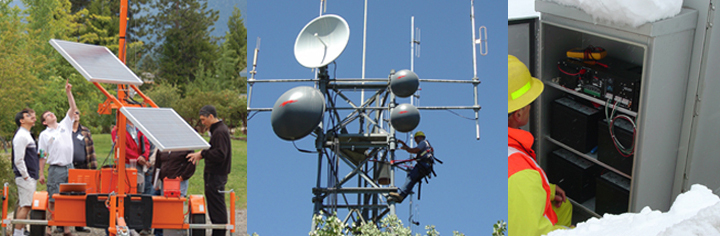
Wyoming Roadside Network and Backhaul Upgrade (pdf)
Keith Tupper, Steve Nickles
Wyoming Department of Transportation

|
Keith Tupper and Steve Nickles from the Wyoming Department of Transportation discussed the redesign of Wyoming’s ITS communication network. With a nod to a 2009 presentation by WyDOT’s Paul Anderson (Creation of an Ethernet/IP Backbone System for Wyoming’s Department of Transportation), Keith and Steve started with background on the existing network, shortcomings associated with it, and the costs in both time and money to keep it running. They reviewed some of the innovations between then and now that have supported the network redesign. They then dove into the new network plan, the redesign process, incorporating redundancy, pilot projects and techniques for network security and isolation. Keith and Steve passed around several different radios for the group to examine and concluded with discussion on lessons learned and next steps. |

Graffiti Detection & Drones (pdf)
Michael Gauger, Kelvin Daratha
Washington State Department of Transportation

|
WSDOT is using unmanned aerial vehicles (drones) for a variety of applications including emergency response and incident management, bridge inspections, and now for graffiti removal. Michael Gauger and Kelvin Daratha teamed up to present evaluation of graffiti tagger detection devices and using drones to remove the graffiti, particularly in difficult to reach places (i.e., bridges, signs, steep slopes). Kelvin started by discussing the project to evaluate four different graffiti detection systems that use cameras, radar, or a combination. He went into detail about the system showing the most promise thus far including equipment, how it works, installation, alerts, etc. He reviewed test results to date, challenges, and lessons learned. Michael then described WSDOT’s use of a drone system to remove graffiti. He reviewed the benefits in terms of safety and cost for using a drone system versus current methods and then explained the technical specifications for the drones. He discussed a number of lessons learned and concluded with a demonstration video of the drone in action. Michael and Kelvin also spent time describing how WSDOT is applying drone technology for bridge inspections, emergency response, and even addressing right-of-way activities. |
Michael Gauger, Washington State Department of Transportation
Photo by Leann Koon
Kelvin Daratha, Washington State Department of Transportation
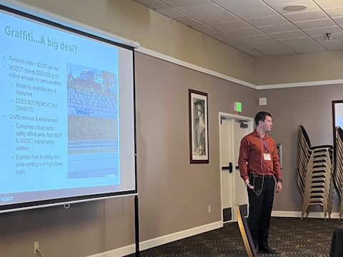
Photo by Leann Koon
Sean Campbell & Ian Turnbull
WSF Founders, Past Steering Committee Members
Caltrans, Retired
The Panel was moderated by Steering Committee Member Doug Galarus, Montana Tech.
, Sean Campbell (center), Ian Turnbull (right)")
 and Ian Turnbull (right) discuss the Western States Forum, its tenets, lessons learned, and how to look to the future.")
In recognition of the 20th Anniversary of the Western States Forum, we assembled a panel of WSF founders to discuss the who, what, where, when and why of this unique event. Rural ITS is, was and will continue to be the frontier of Intelligent Transportation. Sean Campbell and Ian Turnbull, two of the Forum’s founders and retired Caltrans engineers, discussed why “Accurate, Timely, and Reliable” is the measuring stick for performance in this environment, along with other key insight into the state of the practice. The panel was moderated by Doug Galarus, Associate Professor at Montana Tech, who has attended every Forum and been a Steering Committee member from the beginning. Ian and Sean explained the story behind the Forum’s origin and the need for a meeting that allowed speakers (ITS implementers) to get into the nitty gritty details of how things work or don’t work. They commented on the value of frank and transparent discussions, in person networking opportunities, and a vendor free audience. Ian and Sean spoke to being able to try things out in rural environments with limited resources and infrastructure – if it works in the rural context, implementation in areas with more resources and infrastructure (i.e., urban locations with better communications) could be more easily accomplished. They advised perseverance and being able to “work with what you’ve got” to carry the field of Rural ITS for the next 20 years.
TOP